Royal Botanic gardens, Kew - Temperate House, London

Last year in May, the largest Victorian glasshouse in the world opened its doors to public once again. Grade I. listed Temperate house in London‘s Kew Gardens undertook long renovation work by architects Donald Insall Associates. The result is a huge success not only in showcasing the engineering prowess of the past and present but essentially in re-opening this space for conserving the collection of rare temperate plants – the main objective of this project.

1_Kew_IMG_6350.jpg

Kew Gardens was established by princess Augusta of Saxe-Gotha who commissioned head gardener John Dillman to enlarge botanical garden planned by her deceased husband Frederick, Prince of Wales. The gardens opened in 1759 and one of the oldest plant here is tall tree ginkgo biloba planted in 1762, the year in which the first sandwich was served in London.

Temperate house was designed by Decimus Burton (1800 – 1881) in 1859. This glasshouse was then opened in 1863 but the construction continued for the next 36 years. After the turn of millennium the glasshouse was so run down that it was no longer safe for public to enjoy the beauty of diverse plants and flowers inside. With help of funding from National Lottery, private and commercial donors it was possible to start restoration project that took five years to accomplish with the total amount spent close to £42 million. Most of the plants were removed during painstaking restoration however, nine trees remained in situ as they were too horticulturally significant to risk moving them elsewhere.

The embellishments decorating the glasshouse such as statues and urns were recast to the original Burton‘s design. Burton‘s sense for architectural detail is highlighted in terracotta urns placed in each corner of the central building. These urns are in fact concealed chimneys. Their function was releasing the steam from the old heating system.

This spectacular building comprising five pavilions (with its 4880 meters square) houses about 10 000 plants in diverse habitats like for example China, Himalaya‘s, Africa, Australia or Americas. One of the most interesting plants here is Encephalartos woodii, named after John Medley Wood, curator of Durban Botanic Garden who discovered it in 1895. This palm tree like cycad, brought to Kew in 1899, has also been called the loneliest plant in the world because there are only male specimens left – the female Encephalartos woodii has never been discovered.

It will also be interesting to observe the new growth of plants in Temperate house. There are currently unobstructed views from the upper walkway and it will take some time before most plants reach maturity and therefore it is possible to appreciate the expansive view of space inside of this architectural gem.


8_Kew_IMG_6432.jpg
3_Kew_IMG_6353.jpg
4_Kew_IMG_6362.jpg
2_Kew_IMG_6378.jpg
7_Kew_IMG_6417.jpg
Donald-Insall-Associates-Kew-Temperate-House.smal jpg.jpg


Short stories in architecture

Villa Tugendhat (1930)

During my recent stay in the Czech republic I visited two very interesting buildings – Villa Tugendhat in Brno by Mies van der Rohe (1886-1969) and the new Saint Wenceslas church in small village of Sazovice by Atelier Štěpán. The common denominators of these two buildings is simplicity and organisation of space.

Villa Tugendhat was built in 1930 for the industrialist family of the same name. An interesting fact reveals that the design was accomplished with no budget constraints but from the street level this functionalist villa appears to be low, discreet and modest. However, the built area consists of 900 m2 with sloping and expansive garden. This was the first time in architectural history that the steel structure in the form of subtle columns was used in a private house. The building with its architectural details was somewhat related to another Mies van der Rohe’s design, the Barcelona pavilion.

Sadly, the owners did not enjoy living in their home for long as they had to flee the country due to World War II approaching.

In the meantime, it became the headquarters of Nazi Germany secret police, Gestapo. At the end of the war it housed and was devastated by the Soviet cavalry. It briefly functioned as a private dance school or a place for physiotherapy. In 1992 the villa housed historical negotiations about political separation of Czechoslovakia. Since 1994 it is open to public and the villa also became UNESCO World Heritage site in 2001.


1_Villa Tugendhat_IMG_1250.jpg

Villa Tugendhat, Brno, Czech Republic

2_Villa Tugendhat model_IMG_1245.jpg
3_Villa Tugendhat_IMG_1215.jpg
4_Villa Tugendhat_IMG_1225.jpg
5_Villa Tugendhat_IMG_1233.jpg
6_Villa Tugendhat_IMG_1254.jpg
7_Villa Tugendhat_IMG_1235.jpg

Saint Wenceslas church (2017)

The first reference about an intention to build a church in the small village of Sazovice, South Eastern Moravia comes from 1935 assembly of Union of Saint Wenceslas. Two years later after financial contributions from members of this Union a plot of land was bought in auction for a future chapel. However, the World War II put things on hold when German soldiers confiscated remaining finances.

After the end of war a new bell tower was executed in the village. Nonetheless, people still put together another pot of money for chapel but before they could start building, Communists who took power in coup in Czechoslovakia in 1948 expropriated the plot of land and the money left for building new chapel. During the Communism era it was very difficult to have any church approved and built as the only ideology officially permitted by the state was communist doctrine.

After so called “Velvet Revolution” in 1989 there were other priorities in the village to attend to but constant belief of locals in a new church has gradually transformed the idea into tangible design.

Architect Marek Jan Štěpán drew the round shape based on scale and horizontal projection of square-shaped Saint Wenceslas chapel in Prague. Round form also relates to Saint Wenceslas age (10th century) when rotundas were being built in Bohemia. Architect wanted the cylindrical volume to look light as if made from paper. The sections of façade fold inward and outward thus enabling the light coming inside.

This building is also more than a church. In the basement is small cultural centre, a space devoted to lectures, discussions or exhibitions.

This interesting building and its design has also won many architectural prizes and was listed by Azure magazine in 10 Best Buildings in 2017.

8 St Venceslas church_IMG_1348.jpg

Saint Wenceslas church, Sazovice, Czech Republic

9_St Venceslas church_IMG_1335.jpg
10_St Venceslas church_IMG_1350.jpg
11_St Venceslas church_IMG_1343.jpg
12_St Venceslas church_IMG_1344.jpg
13_St Venceslas church_IMG_1349.jpg
14_St Venceslas church_IMG_1341.jpg

Malhamdale, Yorkshire, England

Watlowes valley, Yorkshire, EnglandWatlowes dry valley was formed by meltwater running underneath a glacier for a considerable period of time during last Ice age. The dry stone wall which extends in the valley is thought to be the oldest standing wa…

Watlowes valley, Yorkshire, England

Watlowes dry valley was formed by meltwater running underneath a glacier for a considerable period of time during last Ice age. The dry stone wall which extends in the valley is thought to be the oldest standing wall in the area of Malhamdale. It dates to medieval times when the wall functioned as an ancient boundary between eastern lands of Bolton Priory and western lands of Fountain Abbey.


It was in Carboniferous period, about 300 million years ago, that this area of Yorkshire Dales was a shallow tropical sea. Over a time of about 50 million years a series of limestone beds accumulated at the bottom of this sea. The bedrock got composed from shells of marine organisms and chemical precipitates. Once at the bottom of the sea this limestone formation, now eroded due to slightly acidic rainfall, is to be found at the top, capping the landscape around Malham.

Malham village was founded sometimes in the 8th century. People here grew barley and oats until recently but today the land is dotted by sheep and cattle roaming among the extensive length of dry stone walls. According to survey done in the end of 20th century it is estimated that there are over 5000 miles (8 000 km) of dry stone walls in Yorkshire Dales alone. These walls are dominant feature here and the first field systems may have been built during the Iron Age (about 500 BCE) with the purpose to make livestock safer against wolf’s attacks. Most of the walls around Malhamdale however, were built or rebuilt in the Enclosure period (1780-1840) when government act gradually helped to turn communally owned land into private property. Individual landowners abandoned farming in favour of raising sheep and cattle.

Dry stone walling is done without use of mortar and as such is a disappearing skill on British Isles. Today, this unique trade supports only about 40 qualified dry stone wallers in the whole of United Kingdom.


Malham cove (Winter 2017)

Malham cove (Winter 2017)

Malham cove by moonlight (Autumn 2018)

Malham cove by moonlight (Autumn 2018)

Malham dry stone walls

Malham dry stone walls

Malhamdale limestone pavement

Malhamdale limestone pavement

Malham Tarn

Malham Tarn

Town Head farm, Malham

Town Head farm, Malham

Cheddar Gorge, England

Cheddar gorge in Mendip Hills is the largest gorge in England. This gorge was formed in limestone during last Ice age by meltwater rushing down from glaciers over period of 1.2 millions of years. The river (today called Cheddar Yeo river) gradually made its way underground thus creating a complex underground system of caves. There are now many smaller caves in the area around Cheddar as well as two bigger ones that are open to public. Cox’s cave was discovered by George Cox in 1837 and Gough’s cave by Richard Gough in 1898. The underground was extensively examined by cavers as well as archaeologists and many bones and various artifacts were found. The most distinguished archaeological find (1903) was an almost complete skeleton of so called Cheddar man which is currently on loan in Natural History Museum in London. Radiocarbon dating suggests this specimen lived here around 10 000 years ago. New research into his ancient (degraded) DNA was recently carried out at the NHM and the study proposes that there is high probability this mesolithic hunter-gatherer still had dark skin.

Due to its natural beauty and steep rocks Cheddar gorge is a great place for climbers. It is also generally touristic place that is visited by nearly half a million people every year. The road B3135 winds through the gorge and is an ultimate test for drivers, bikers and cyclists alike. Not all people come to see protected landscape as their priority because this area is also very famous for its cheddar cheese that is still being produced in the village.

1_IMG_0119.jpg

Cheddar gorge

2_IMG_0111.jpg

Cheddar gorge (Heart Leaf Bluff) by moonlight

3_IMG_0171.jpg

St. Paul's chamber at Gough's cave

4_IMG_0106.jpg

Road B3135 (Horseshoe bend)

5_IMG_0152.jpg

Road B3135 through the gorge

6_IMG_0177.jpg

Gough's cave

7_IMG_0366.jpg

Skeleton of Cheddar man at Natural History Museum, London

Walks in English countryside

Some time ago I was given old Czechoslovak camera called Flexaret IV. Apparently it wasn’t in use for long time, hidden in loft of a household gathering the dust. It is a medium format camera very popular during 50’s and 60’s. In those times it was preferable choice for amateur photographers beyond eastern Europe and indeed very popular with Czechoslovak families. This camera utilizes square format (approximately 6X6 cm) and uses 120 film which was initially introduced by Kodak for their Brownie No.2 camera in 1901.

It looked in good repair and after I cleaned it I realized that this camera was in really good condition. I ran through it Ilford film in order to find out whether it was worth keeping for the actual use or to be kept as a decoration or perhaps even a collectable item. The resulting images pleasantly surprised me. I started to take the ‘box’ with me on walks with my friends in English countryside as I wanted to have images with different feel as pictures taken by today's camera phones are just too ubiquitous. Another, more tangible reason for its use on my walks is that I do not want to carry the weight of my main camera kit on my back.

It is all manual camera made in 1957 and its design, function and durability makes it still possible to take photographs after 60 years since it was made by Meopta company in Přerov.

1.jpg
2.jpg
3.jpg
4.jpg
5.jpg
7.jpg
9.jpg
6.jpg
8.jpg
10.jpg

Archeopark Pavlov, Czech Republic

The landscape of Pálava hills is rich in archaeological finds dating to 30 000 BCE. During extensive excavations in region of South Moravia archaeologists unearthed number of Paleolithic settlements as well as great amount of stone and bone tools, artworks, skeletal remains of old stone age humans and animals including mammoths.

Initial idea for a museum was conceived in 2003 and it took further 13 years to design and build this subterranean exhibition space. The concept of underground structure was considered due to number of reasons. The Institute of Archaeology CAS (museum’s commissioning body) wanted to display certain finds in their original context post-excavation. And another reason was that the location chosen for the museum was within protected landscape area.

The museum was designed by architectural studio Radko Kvet and the exhibition combines traditional display with the latest AV technology. The exhibits on show include copy of the most famous find called Venus of Dolní Věstonice (the priceless original is housed in Moravské zemské muzeum in Brno). This small ceramic statuette of a woman was found in nearby village of Dolní Věstonice and has recently been dated to circa 29 000 years BCE. Unlike similar figurines made from mammoth’s ivory found in France, Italy or Russia this one is made from fired clay and therefore significant in broad cultural and technological sense.

The museum building has won number of architectural prizes and its design connects this landscape to our prehistoric ancestors deeper in time.

1_IMG_9712.jpg
2_IMG_9649.jpg
3_IMG_9676.jpg
4_Archeopark exhibits.jpg
5_IMG_9700.jpg
6_IMG_9697.jpg
7_IMG_9680.jpg
8_IMG_9678.jpg

Christmas in Cairngorms (The story behind the photograph)

Loch Etchachan, Cairngorms, Scotland

Loch Etchachan in Cairngorms is situated within the central plateau deep in Grampian mountains. Being 927 meters above sea level, it is the highest body of water of its size in Britain. The loch is totally ice free only for short periods of time during a year. It is classified as oligotrophic (meaning nutrient-poor) and is devoid of fish. This remote place best represent Arctic-alpine character of these mountains, unique in British Isles.


Cairngorms (Am Monadh Ruadh) are a mountain range that is part of Grampian mountains in the Scottish Highlands. The Cairngorm plateau is the largest area of high ground in Great Britain and as such is prone to heavy snowfall not only in winter.

In May 2015 I spent 10 days roaming alone in Cairngorms walking through Lairig Ghru, Glen Derry, Strath Nethy and Glenmore. In the beginning of this trip I had a goal in mind – climbing the summit of Ben Macdui (1309 m), the second highest peak in Britain which was on my route. However, it turned out differently than planned due to particularly bad weather. The freezing conditions, constant rain or snow and especially persistent high winds made me abandon this idea for safety reasons. I remember at the time how much I appreciated staying night in a bothy (Hutchinson Memorial Hut) in Coire Etchachan as a gale raged outside.

Since that time I wanted to come back to these remote, inhospitable but uniquely beautiful mountains again. This came finally to fruition during Christmas trip to Scotland when I joined friends and experienced mountaineers Fedor & Andrea who climb in Himalayas and other mountain ranges in Alpine style.

Initially we did not set off for Cairngorms but rather for Isle of Skye on the west coast. However, during the journey to Scotland more favorable weather forecast was pointing towards Cairngorms. The providence at play, perhaps. We timed ascent of Ben Macdui just after Christmas  (2017) because the detailed mountain weather forecast indicated clear views from the summits. Needless to say the weather didn’t turn out according to forecast models shown on dedicated information services.

We left from Linn of Dee via Derry Lodge. The board at the lodge displayed information that the small bridge over Derry burn down the glen wasn’t quite in order therefore we took the path on the left bank. It was slightly drizzling and the weather did not suggest winter conditions ahead. Most of the snow thawed and there was very little of it lying up on the hills. We reached the bothy Hutchinson Memorial Hut built in 1954 in memory of Arthur Hutchinson (1902-1949), an Aberdeen born geologist. This was supposed to be our base for few days. Here we were greeted by 55 year old bearded man called Hugh. He has been a MBA (Mountain Bothies Association) member for a long time and as he revealed later on he was the first person who slept here after a substantial update in the form of extension in 2014. Hugh was warm and knowledgeable Scot who came here to prepare and test the routes on which he would be guiding group of tourists in March. As a person with considerable experience in these mountains he had had practical enrichments stashed around places for use when he would be in these parts. As darkness fell and the cold became colder we learned what these things were: wood, coal and whisky. All of them fuel and mood enhancers, if used in convenient way.

The fire in stove transformed the atmosphere in bothy. It was Christmas and our evenings were filled by telling stories, eating food and sipping single malt whisky. Good fire in a stove is, according to author of The Scottish Bothy Bible, Geoff Allan, known as “bothy TV”. Starring into the fire can be mesmerizing and could even prove to be fatal. This we learned when carbon monoxide detector mounted on the inside wall went off. Science works. Thank goodness.

In the night the snow fell and put a white blanket over the landscape. During the day the wind was very strong and we made a walk only to Loch Etchachan, the highest body of water of its size in Britain.

                         Photographs by Andrea and Daniel

                         Photographs by Andrea and Daniel

Our food was going down so we decided to go for Ben Macdui the next day, regardless of weather conditions. Hugh was also going with us and we set off from bothy during blizzard. Snow crystals stung our faces all the way up to Loch Etchachan. After changing direction the wind was blowing from the side. Hugh was leading our party most of the way up but Fedor was also checking the route using his skills and devices. The snow cover was thin with grasses and stones peaking out however, the drifts piled up at places. The visibility was very poor and we benefited from Hugh’s knowledge of the path in dreary terrain. The cairn we reached signified the Ben Macdui plateau. We were not far off the summit but stopped here unlike the wind that continued blowing relentlessly. Fedor made visible arrow in the snow in order not to get confused what direction we came from. This wasn’t summit proper and Hugh decided to walk another 150 meters to get there. We stayed put, looking at his large body disappearing into whiteness of the snow storm. The way down was actually much harder, at least for me. Going against the wind and face the stinging snow crystals was painful. Our previous footprints all but disappeared with the falling snow. This was a harsh environment. My cheek started to freeze and my fingers too. The wind chill factor made temperature even lower. The maximum wind speed recorded by automatic weather station built by Physics department of Herriot-Watt University on the summit of Cairn Gorm (1245 m) is stated in the book by Patrick Baker - The Cairngorms: a secret history to have been 176 miles per hour (283 km per hour). Comparing our struggle to such mayhem would be unimaginable. Still, it was difficult to breathe, hard to keep my eyes open. Hugh then caught up with us and we got safely back to bothy.

Although we did not get up to summit proper it was great journey to experience winter in Cairngorms and that in spite of cold conditions, strong winds and noisy rattling tents at nights. And as the old saying goes, the journey itself is more important than the destination. It certainly proved to be the case.


                         Photographs by Hugh, Fedor and Andrea

                         Photographs by Hugh, Fedor and Andrea

From the Archives – Zimbabwe 2001

Recently, with much interest, I followed news in various media about events in Zimbabwe. Former president Mugabe has now resigned from his post after being put under pressure from his own army. People in Zimbabwe celebrated in the streets and hope in general is held high for this African country. Time will tell whether the change of personnel was for better or for worse. I wish for the former to be true.

In 2001 I travelled in this beautiful country and later on published my first ever article in Czech geographical magazine Lidé a Země. Here is an English translation of that article which appeared in the magazine in March 2003

The Smoke which Thunders

Applying for the visa to Zimbabwe, politically and economically chaotic country has been quite a problem. Finally, after ten days of waiting and urging the authorities to get my visa processed, my passport is stamped in Johannesburg and the way to Zimbabwe is open to me. My hopeful goal is to reach Victoria Falls.

First however, my journey takes me to a town called Bulawayo (translated as “town of killing”). I obviously knew the media stories about fate of white farmers, opposition politicians and journalists, so even the name of the town endangers in me some sense of unease.

We reached the border at the town of Beithbridge in the morning. Even before our arrival, still in South African territory, several Zimbabwean women boarded the coach in search of “western” currency in exchange for their Zimbabwean dollars. At the time when an economic embargo has been imposed on this country due to political repression practiced by the current president and dictator, Robert G. Mugabe, any “hard” currency has served to provide at least some improvement in living conditions for ordinary people.

There were already many coaches queuing at the border. Getting my passport stamped along with hundreds of people surrounding counters was nearly impossible task.

Outside, I am at once confronted with huge poverty here. Begging children are approaching me. They escort their blind, legless or otherwise handicapped grandparents injured during war for independence. As no structure of social services exist in Zimbabwe, these people have to rely on begging which may be their only source of income.

On the way to Bulawayo the landscape is somewhat hilly and dotted with boulders of various shapes and sizes. These boulders follow me up all the way and are the main features along the route. During three hundred kilometers the coach has passed only four cars going opposite direction. At the time when a petrol crisis was coming to a head in the whole country, it was difficult to get any petrol at all. When approaching the outskirts of the town Bulawayo I noticed two things: long queues at petrol stations (with no drivers in their cars) and expansively wide avenues. These wide avenues were built by Cecil J. Rhodes who came to Zimbabwe as a colonizer and diamond prospector (this former British colony called Rhodesia was named after him). He required such wide avenues in order to accommodate the width of fifteen harnessed oxen one next to the other.

The town itself is well planned and despite visible poverty the streets give nice impression. It is easy to orient oneself and looking for a railway station takes only a moment. Once in there I found out that after four days of temporary closure of railways the Ministry of Transport has obtained some supply of diesel. This means that railway can be reopened for at least a week I am assured by officials.

I meet a man called Sydney. He together with his girlfriend invite me for lunch. I accept the offer and they lead me to a nearby restaurant. Sydney is from neighboring Zambia but he has been living and working here at the train station for several years. I learn from Sydney that Bulawayo and nearby villages are in a region which supports foremost the political party of Morgan Tsvangirai MDC (Movement for Democratic Change). His party struggles in opposition against the ZANU-PF party of the current president Mugabe.

Sydney’s talk has been interrupted by waiter. He brings us wash-bowl with water. It serves for hand-washing before every meal. Here they eat using hands with no cutlery. There is a traditional sadza on the table – rigid corn porridge – and also stewed beef.

After the meal I learn about another criticism of the current regime from other people’s mouths. I meet a woman who leads me on to show me the conditions in which people have to live here. Unemployment in the country has reached fifty percent. Many people are forced to live right on the streets or in slums made of cardboard boxes.

It is surprising since after winning independence Zimbabwe has followed what appeared to be a good path. Unfortunately today, this path does not seem to be in the interests of ordinary citizens and the country has lost its way. After the colonizers left the developed industries remained in the country. Based on rich resources of mineral deposits Zimbabwe has become a prosperous developing country with reliable income from tourism. However, unjust distribution of land and bitter disputes between the leading parties have halted the promising economic growth and thus contributed to a rise in unemployment. The repressive policy of president Mugabe placed this country on the verge of civil war.

Still in Bulawayo I met few other foreigners and we assembled a little group and hired a tracker and guide called Stanley. We are going for safari to Matobo National Park.

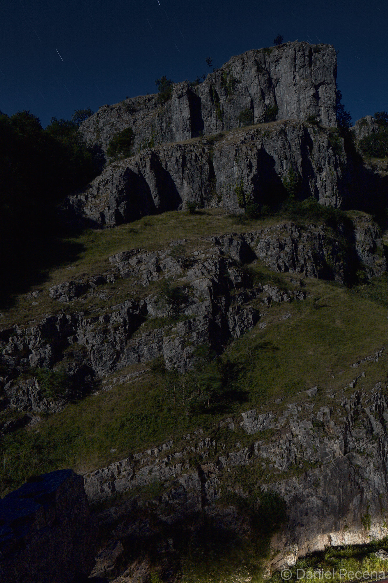
It is raining. The chance to see white rhinoceros in their natural habitat is now diminished. But for now there are other species to see here: wildebeests, zebras, hippos, giraffes and many more. Matobo National Park is also famous for the rock formations which are “sowed” far beyond its frontiers. Some of these rock formations are associated with all kinds of stories and legends. They are considered by locals to be sacred. It is believed that even pointing at them can bring misfortune for the rest of one’s life. Stanley gives us this information beforehand and therefore he doesn’t point at the peak called Shumba Sham out of superstition when we are passing it. Looking at these works of “Mother Earth”, it is incredible that they were created solely by natural processes of volcanic activity and subsequent erosion. Behind a ford we have suddenly seen a group of five rhinos. Stanley has given us some quick instructions as what to do if we are attacked. Then, we got off the car and sneak closer to them. They are by the river, drinking. Still, they do not sense our presence. Stanley whispers that if those were black rhinos we couldn’t have possibly got so close because they are more aggressive. Rhinos have developed good sense of hearing and smell. They also distinguish faster movement very well so we cannot do anything rush.

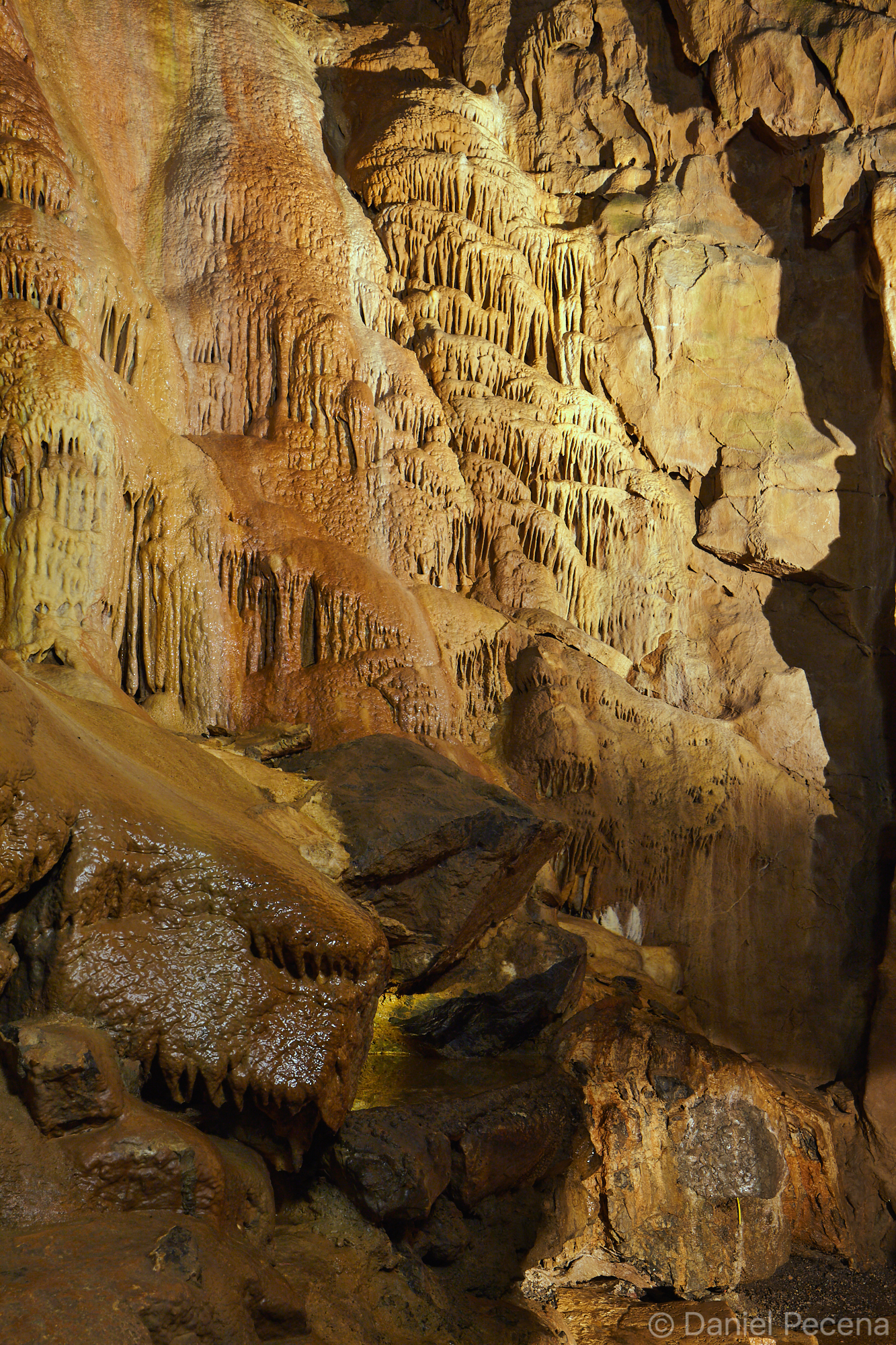
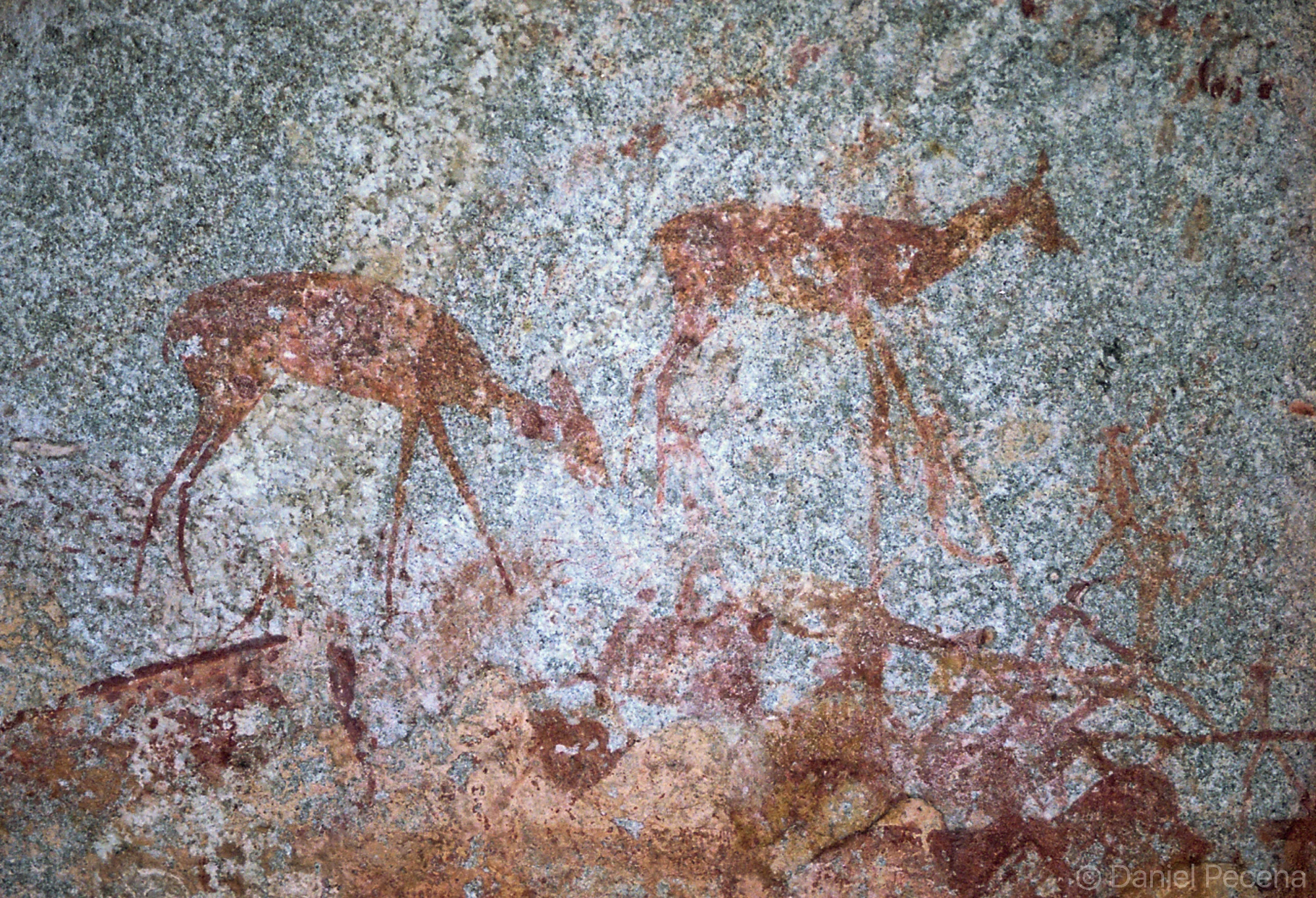
After this experience on foot in animal kingdom we are walking in meditative mood towards a hill on which there is a cave called Nswatugi. There are ancient paintings of the San people also known as Bushmen. At the entrance to the cave all becomes transformed as we are going back ten thousand years to the time when these paintings were created. Among all those paintings on the cave walls the most mysterious one could not be seen in normal light conditions. We had to diminish the impact of the light on the rock by whatever means and when the intensity of light was lower the rock has released a “three-dimension-like” painting of an animal. We test the appearance and disappearance of the painting again and again. With such experience one is made to think deeper about the sense or purpose of this art that was created by “primitive” Bushmen tribes. We are finishing our day on a hill called Malindzimu (Sanctuary of Ancestral Spirits). This place is an inselberg where big boulders are spaced out upon a vast stone plate. Apparently the whole world can be seen from this place. The landscape around had come to existence by tectonic movement three billion years ago. Today this place is also known as resting place of Cecil Rhodes who chose this land for his grave and named it View of the World.

I prepare myself for the sleeper train journey to Victoria Falls town. The train is the only transport in this country which still sometimes operates albeit with days of disruption. The train runs very slow and often stops due to signal failure. The falls let one know about their presence long before one’s arrival. The “smoke” has risen up to half kilometer from the cataract and can sometimes be blown by wind up to eighty kilometers from there.

Standing on the bridge between Zimbabwe and Zambia the falls can be seen only partially from here. I rather admire the bridge itself which carries a piece of interesting historical mark. This bridge was officially opened by Francis Darwin, son of famous biologist and author of Evolution theory. The architect of the project was Ralph Freeman who basically copied a structure of a bridge in Sydney harbour. The construction was financed by Rhodes’ company; unfortunately he died before the bridge was finished. The river Zambezi which has its source in Mvinilunga region in north-west Zambia flows hundred meters below.

When I have finished this viewing I finally walk towards rainforest for closer look at the falls. The sun is shining and its rays penetrate the foliage and together with the scatter of spray create rainbow which is still about three meters from me. In spite of knowing I cannot succeed I am trying to catch it. All my steps are made in the midst of intense thunder and with the first look at the falls I contemplate how exact the name Mosa-oa-Tunya (The Smoke which Thunders) is. This name was given to the waterfalls by Kololo-lozi tribe who had lived on the banks of the river Zambezi from ancient times. The falls were renamed in 1855 by the Scottish missionary and explorer David Livingstone who named them after the Queen Victoria. Viewing the Devil’s cataract, one of the five parts of the waterfalls, I ponder. It is seriously hard to describe the feelings that pass through me. The words of Jiri Zeman who lived and worked in Africa for many years seem to be the accurate description: “Hundreds and hundreds of books and brochures describe the waterfalls but even the greatest of photos cannot substitute for the imminent impression of bulkiness, water scattering and the roar of thunder.” The most intense flow of water is in the rainy season in March and April. At that time 720 million of litres of water fall down the gorge per second. It is then understandable that such a vast flow causes severe progressive erosion which slowly destroys the bedrock of the falls. Their width, currently spanning 1.7 kilometer is therefore constantly changing with the flow of the rivers and alters its position. This process has already recreated the falls eight times during the past half million years and this will last as long as the water in the Zambezi river continues to flow.


Mosa-Oa-Tunya

Mosa-Oa-Tunya

Malindzimu hill (dwelling place of the generous spirits)

Malindzimu hill (dwelling place of the generous spirits)

Nswatugi cave painting

Nswatugi cave painting

Roca London Gallery

During the annual Open House in London I visited this relatively small place with complex design. It is certainly not an ordinary shop.

Roca Gallery London was designed by Zaha Hadid Architects as a gallery and presentation showroom for leading bathroom and tiles manufacturer. This complex and innovative space creates interesting visual experience that may be comparable to moving through a cave or canyon. It is no wonder as the inspiration to the architects was indeed water – its different forms and attributes. The gallery occupies one floor and there are two main features in its design. Firstly, it is continuity and fluidity of space which twists and turns creating one seamless experience of movement through the interior. Secondly, it is the contrast between materials used: GRC (glass reinforced concrete) and GRG (glass reinforced gypsum). The space is not only used for showcasing Roca’s products but also for exhibitions, public lectures and other events.

1_IMG_8401.jpg
2_IMG_8346.jpg
3_IMG_8372.jpg
4_IMG_8420.jpg

Serpentine Pavilion 2017

The classical style Serpentine Gallery in Kensington Gardens was built as a tea room in 1934 and serves as gallery since 1970. By the time it firmly established itself as a pioneering institution showcasing contemporary art.

Since 2000 new temporary addition to gallery in form of pavilion was conceived by former Director Julia Peyton-Jones. Thus, every year an internationally renowned architect is commissioned and has got just 6 months to design and build Serpentine Pavilion in front of the gallery for visitors to enjoy. Due to this fascinating programme summer in London’s Kensington Gardens is enriched with unique structure. The same place is different on every occasion and every design contributes to great diversity of ideas presented. The idea, design, construction and implementation is being discussed well beyond London.

This year the pavilion was designed by Francis Kéré and his Berlin-based practice. The architect was inspired by gatherings under tree canopies in his home country, Burkina Faso.

Below are also some other pavilions designed in earlier years.


Francis Kéré 2017

Francis Kéré 2017

Francis Kéré 2017

Francis Kéré 2017

Francis Kéré 2017

Francis Kéré 2017

Francis Kéré 2017

Francis Kéré 2017


Bjarke Ingels 2016

Bjarke Ingels 2016

Bjarke Ingels 2016

Bjarke Ingels 2016

selgascano 2015

selgascano 2015

Sou Fujimoto 2013

Sou Fujimoto 2013

Herzog & de Meuron and Ai Weiwei 2012

Herzog & de Meuron and Ai Weiwei 2012

Peter Zumthor 2011

Peter Zumthor 2011