
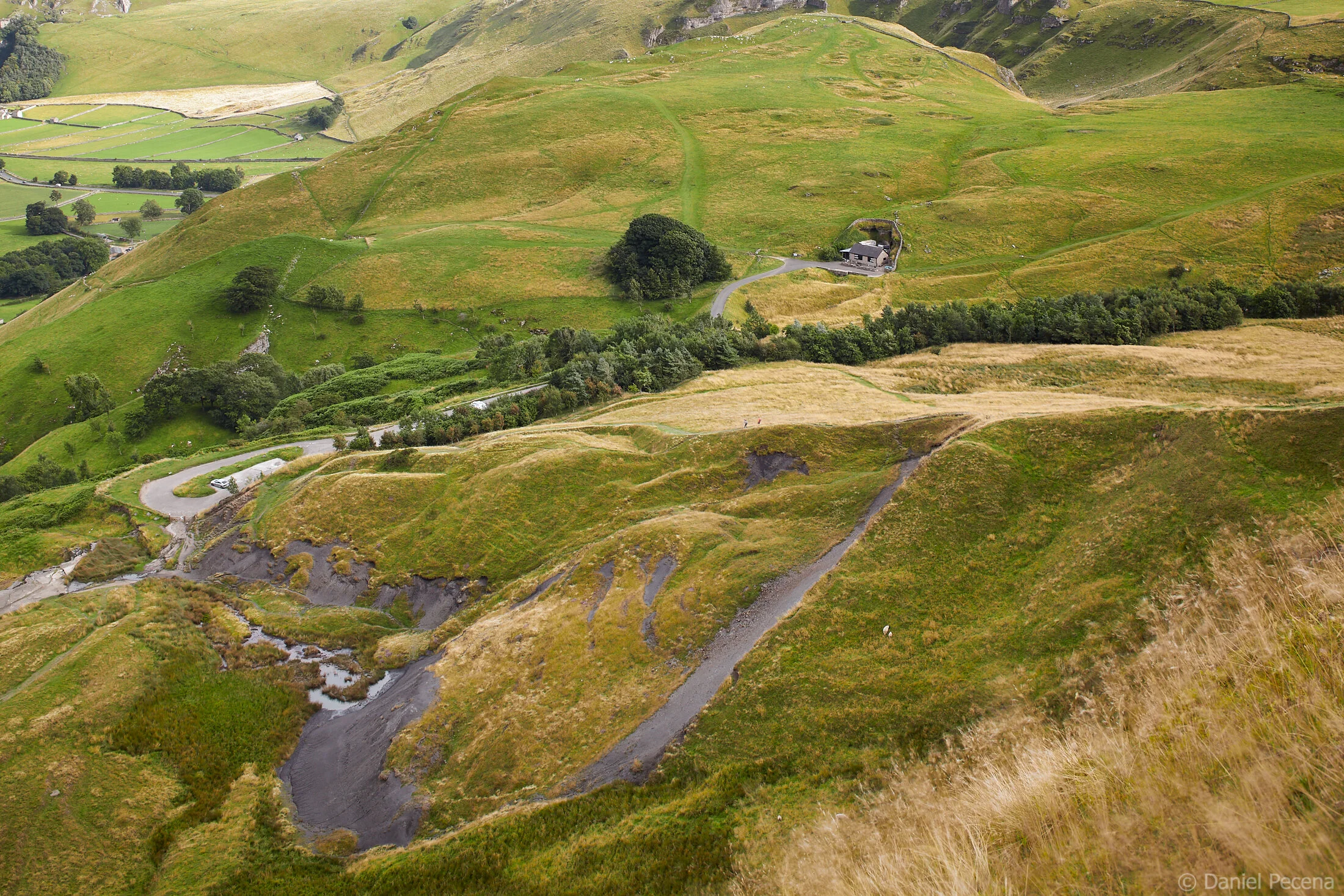
Looking down on the streams of vehicles moving through the Winnats Pass in Derbyshire I can hear only a slight humming noise from all the car’s engines produced below. Here at my level above the gorge, sheep’s bleat is still more dominant clamor. This part of the Peak District National Park in England is busy with traffic, especially in summer months when tourists come over here to enjoy the hills and numerous karst caverns inside them.
The name Winnats Pass (now also known as Arthur’s way) is derived from words ‘wind gates’. Its highest point is 383 meters and comes with impressive maximum gradient of 28 %. Such steep climb was the reason that this road was not being used as much as the nearby road designated A625 which went around the Treak Cliff hill. Over the 20th century, this road, routing on eastern side of Mam Tor (517m), had been subject to countless repairs due to many landslides on the flank of this hill. And because of the constant problems with these landslides, this road was finally closed in 1979.
View from Mam Tor on Treak Cliff with the entrance to Blue John Cavern
The view from the side of Mam Tor to its foot reveals the extent of landslides in more clarity. The hills are still ‘breathing’; they never stay still as the geological processes are in slow-moving action. And thanks to geological processes, there are now three caverns inside the Treak Cliff hill that are accessible to general public (Treak Cliff Cavern, Blue John Cavern and Speedwell Cavern).

The Fossil Cave with crinoids

The Dream Cave with stalagtites

The Witch’s Cave and rock with Blue John mineral

Aladdin’s Cave with multi-coloured flowstone

Blue John stone table top (fragment), Treak Cliff Cavern museum


Digging deep started in this area near Castleton village with led prospectors leading the way underground. By 1750’s there was more than 15 working mines in Treak Cliff alone. However, rather than mining led, these mines specialized on finding Blue John stone (fluorspar) which is a semi-precious mineral that had been largely used for making jewellery, ornaments, goblets and parts of furniture. Even in the height of mining production in the 18th century, the leases limited output to about 20 tons per year. When Blue John artefacts ceased to be fashionable in the early 20th century production did not stop entirely. Today the output is limited to one ton per year, and is mined mainly in Treak Cliff Cavern during winter months when visitors to these caves are scarce. Phasing out mining hasn’t stopped exploration of local underground. Since the 1920’s numerous new caves, routes and chambers have been discovered and today’s visitors can admire stalactites, stalagmites as well as various other rock formations and even fossils such as crinoids on routes through the show caverns.
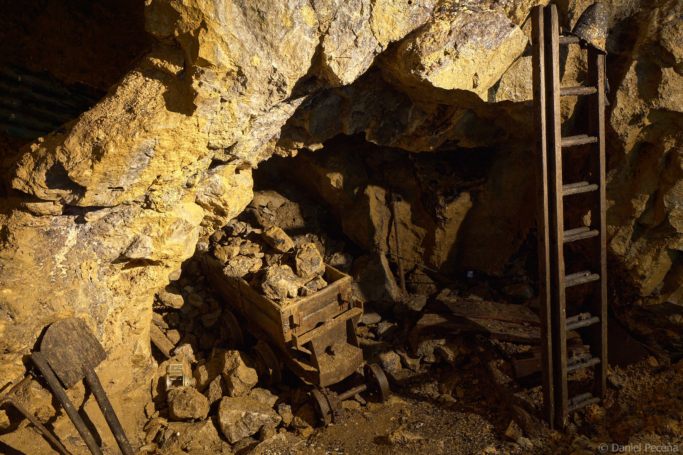
Former mine in Treak Cliff Cavern near Castleton
Deep gorge where the Winnats Pass makes its way had been created by force of meltwater from glaciers running down at the end of last ice age about 10 000 years ago. Water has also been instrumental in creating the caves and passages in limestone rock over the course of millions of years. In Carboniferous period, about 350 million years ago, this area would have been at the bottom of a shallow tropical sea, still at the beginning of a journey forward to our times.
Treak Cliff and Winnats Pass at night, Peak District, England
Treak Cliff and Winnats Pass, Peak District, England

Edward Burra (1905 - 1976) - English Country Scene I.