The story of Snettisham nature reserve isn’t completely natural. This landscape had been transformed by people and subsequently by nature’s course of events. Today the salt marsh, saline lagoons, mudflats and beach make up a place devoted to wading and migratory birds who live next to people in bungalows and static caravans. Both governed by the sea, climate and geological processes.
New day was beginning in Norfolk. Crisp and freezing morning made the fresh hot brew just a little bit more appreciated than normally. The sky was clear and with the first light we started to see pink-footed geese flying in V-formations above our heads. Scientists think that their typical honking cry enable them to maintain integrity of the flock and to co-ordinate position shifts in the V-formation they fly in. After we looked up several times at flying geese, mist began its slow descend, exactly as weather forecast for today.
We had been on the way towards the Wash, the largest estuarine system in Britain. It is situated in the north-west corner of East Anglia where Norfolk meets Lincolnshire County. The frost dressed surroundings into white garb and mist was occasionally penetrated by the sun rays. Listening to classical music the drive through Norfolk countryside resembled a fairytale. Number of pink-footed geese standing on the thin ice covering part of the pond in Bircham Tofts made us stop by. This small body of water was paradise for other countless waterfowl. Nearby, the gaggle of geese was much larger and with loud honking made their way through the pond towards the open field behind it. It was feeding time.
On the crossroad we stopped again. In front of us was St Mary’s church, its spire hidden in mist. This church in Snettisham was built in 1340 and its tall tower still acts as a beacon for sailors in the Wash to this day. We drove into the village which is known for ancient archaeological finds. It was nearby on the Ken Hill in 1948 when a farmer who was deep ploughing a former lavender field unearthed a piece of twisted metal. First he thought that it may have been just a part of an old bedstead and left it lying on the side of his field for several days. Eventually he came back with local archaeologists who uncovered Iron Age gold and silver torcs inside shallow pits cut into the carrstone bedrock. More discoveries followed around the village later and these finds are now known as Snettisham hoard. Some of the artefacts are now housed in Norwich Castle museum and in the British museum (room 50) in London.

Snettisham hoard, British Museum, London
We arrived in the car park of Snettisham nature reserve which as the nature reserve itself is managed by RSPB (Royal Society for Protection of Birds). As a conservation charity they are responsible for protection of birds in their environment and they manage over 200 nature reserves throughout the whole of UK. Narrow path from car park led us towards elongated lagoons. On the way through mist we walked alongside bushes covered by frost. Only rose hip with its bright red colour was breaking the ambient uniformity. Looking at the lagoons, it is not easy to see that they were created artificially by people extracting shingle for building industry. The Etna Stone and Shingle Company operated here since 1920s and quarried gravel, stone, shingle and sand. An interesting fact is that it was here on the beach where by extracting shingle the foundations of a bungalow was found. It had previously been owned by Alexandra of Denmark who was Queen consort of the United Kingdom as the wife of King-Emperor Edward VII. This bungalow was built in 1908 and demolished in 1925, the year in which Alexandra died in nearby Sandringham Hall - the private retreat of British monarchs since 1862. Some of the materials from her demolished bungalow were used to build Shernborne village hall within the Sandringham estate.
Later in 1930s whole series of holiday bungalows started to grow on the land owned by the Etna Stone and Shingle Company. Some were also built on the bank along the sea. With the World War II. coming, the whole area was requisitioned by the Military. At the beginning of the war the RAF (Royal Air Force) have moved in and established a gunnery range. Later on the area housed 8AF Provisional Gunnery School under the USAAF (United States Army Air Force), providing training for soldiers to operate B-17 heavy bombers. At some point during the war this area was also POW (Prisoners of War) camp. According to the Snettisham Sailing Club, “the prisoners were employed as part of the war effort to excavate the shingle to build concrete runways for new airfields. Twenty years of normal supply of shingle was taken out in just three years, leading to the formation of the lakes.” The sea water has partially filled these artificial lagoons during 1949 surge when the storm was initiated in south-west of Greenland and again during much more severe and devastating event in 1953 which affected the whole east coast of Great Britain.
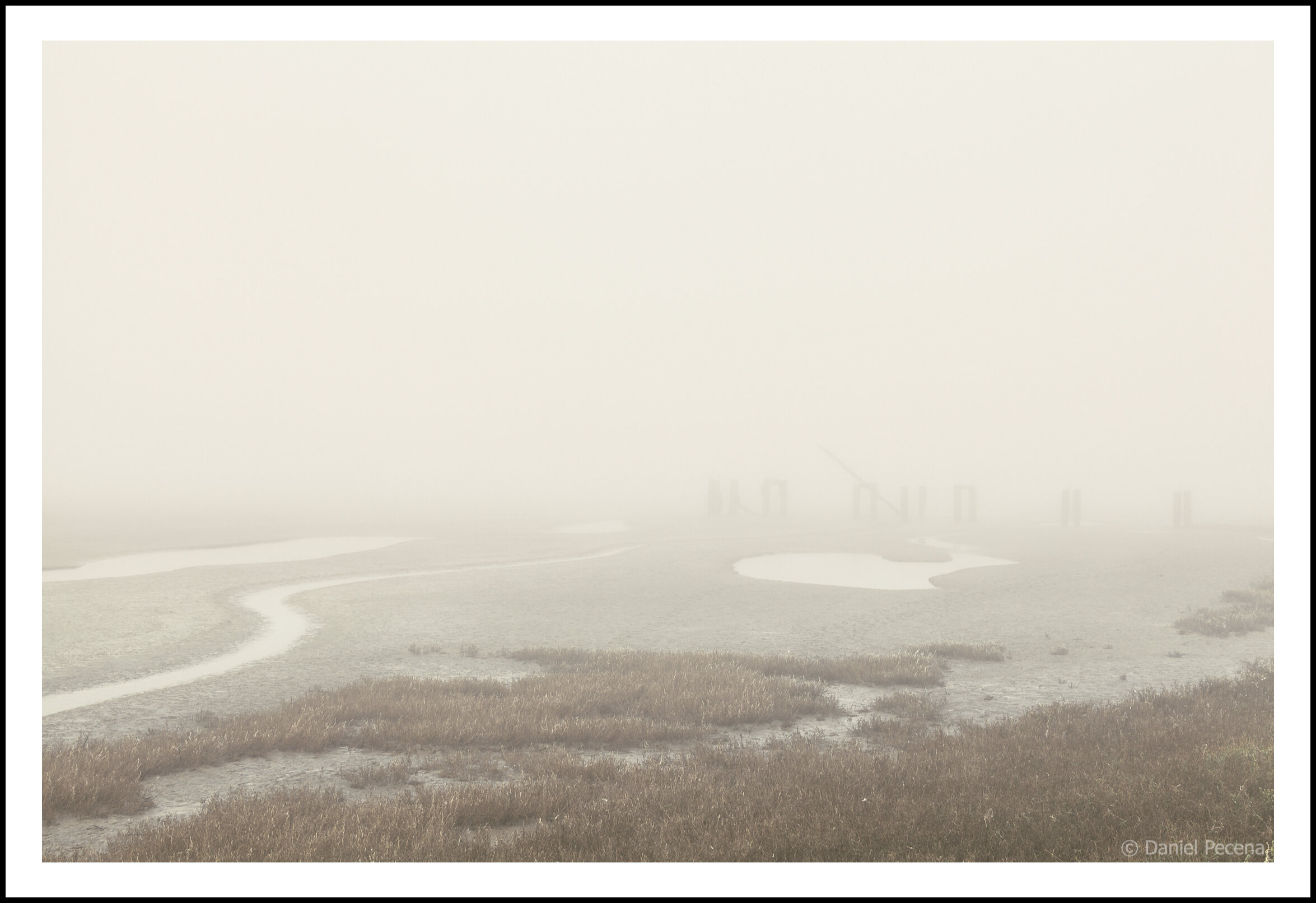
Snettisham jetty, Norfolk, England
Wooden remnants of jetty in Snettisham beach extends into the misty mudflats of the Wash. The structure was still in use for loading the extracted shingle onto boats for transport during the first half of 20th century. In more distant past the local beach was also exploited for smuggling operations to avoid docking with illicit cargo at nearby seaport King’s Lynn.
The Waverley report presented in 1954 by John Anderson, 1st Viscount Waverley says that the flooding which took 65 lives in Snettisham area alone was caused by combination of factors. Relatively high spring tide together with rotation of the Earth ensured that the water was deflected to the west of the tidal currents, thereby hitting the east coast. Another factor which may have contributed to this disaster is a process called isostatic adjustment. According to The ‘Coastland Map’ produced by scientists from Durham University and published in the Journal GSA Today (2009), the retreat of the ice sheet since the last Ice Age 20,000 years ago means that the release of this enormous weight resulted in the landmass slowly tilting back up in the north or down in the south. The team led by professor Ian Shennan predicted that [sea] levels will continue to rise as the land falls, at a rate of 0.4 to 0.7 millimetres a year. “Subsidence and rising sea levels will have implications for people and habitats, and will require action to manage resorts, industrial sites, ports, beaches, salt marshes and wetlands, wildlife and bird migrations,” stated Professor Ian Shennan. (Durham University. "New Coastland Map Could Help Strengthen Sea Defenses." ScienceDaily. ScienceDaily, 8 October 2009. <www.sciencedaily.com/releases/2009/10/091006201354.htm>).

Tide predicting machine, Science Museum, London
This is the special purpose analog computer designed in 1872 by Sir William Thompson to predict the ebb and flow of the sea tides and the irregular variations in their heights in order to create tide table. Thompson’s work was later further developed by George Darwin (the second son of Charles Darwin). Similar but more complex tide predicting machines were continued to be used until 1970s when they were surpassed by digital electronic computers.
When I am standing between the heightened sea bank and one of the shallow lagoons I can just make up in the mist the row of houses along the beach. Here I find the warning sign saying: “This area is at risk of tidal flooding — a precautionary evacuation of this area may occur at any time.” Right below this sign in Pit 2 as the lagoon is formally designated are the remnants of concrete blocks sticking out of the water. These blocks were once part of the road built by USAAF between Snettisham and Dersingham during the World War II. When the road was destroyed in the flood in 1953 those large pieces of concrete were carried here by receding water. Some time after the war the northern part of former military camp had been built over and turned into caravan park. Then in 1961 the quarries finally closed. However, despite the adjustments of the land this area is still prone to flooding from the sea and the last precautionary evacuation due to this risk happened in September 2019.
Snettisham lagoon (Pit 2), Norfolk, England
The concrete blocks are the fragments of the road built by USAAF personnel between Snettisham and Dersingham during the World War II. When the road was destroyed in the flood in 1953 those large pieces of broken concrete were carried here by receding water. The brackish shallow lagoons of Snettisham nature reserve attract hundreds of thousands of birds throughout the year. These gravel pits were formed by people extracting shingle, gravel and sand for the building industry.

We continued walking alongside the mudflats laid bare by ebb tide. The wading birds like knots and oystercatchers were busy feasting on shellfish and prawns, but they were far away. The birds could be heard but not seen through prevailing thick mist. Solitary peregrine was circling the area above in cold air looking for its late morning meal. Sitting on a foldable chair a bird watcher equipped with a telescope and camera was observing the scene patiently.
We have moved on again and met Phil. The RSPB warden told us a lot of interesting information about bird’s behaviour and this nature reserve as a whole. It is advised to check the local tide table as the best time to come here to see the “whirling wader spectacle” is about two hours before the spring tide. The incoming seawater pushes knots, dunlins and oystercatchers towards the beach and they, at certain moment, take off in their thousands. Today the high tide was only 4.25 meters but the height needed for the birds amazing spectacle is over 6 meters. Anyway the bad visibility would have prevented us seeing this spectacular phenomenon.

Snettisham wader spectacular

Snettisham wader spectacular
Up to 400,000 pink-legged geese are wintering in the UK every year. And about 40,000 spend the winter near Snettisham. These migratory birds fly in from Greenland and Iceland in late October and go back in February. They stay in nature reserve overnight as this place is safe from predators or other disturbance. In the early morning they fly into interior to graze in the local fields on post-harvest sugar beet tops. There are no records about the pink-legged geese here prior to 20th century. Also records for the first half of the 20th century are a bit sporadic. Then in 60’s when co-ordinated censuses of wildfowl started there were sightings of flocks with 200-300 birds. Subsequently the number of pink-legged geese started to increase steadily. (Mitchell, CR & RD Hearn. 2004. Pink-footed Goose Anser brachyrhynchus (Greenland/Iceland population) in Britain 1960/61 – 1999/2000. Waterbird Review Series, The Wildfowl & Wetlands Trust/Joint Nature Conservation Committee, Slimbridge)

Pink-footed Geese at Snettisham, 1960/61-1999/2000: peak counts (bars) and British index (line) (circles denote years with no known data)
During the time in the reserve we surveyed all four hides. Two of them had to be rebuilt after 2013 storm deluge destroyed one of them, while the other one disappeared completely. These hides have a perfect location for observing the wildfowl in their environment. RSPB had crowdfunded the project which was designed by Norwegian architectural studio Biotope specialising in bird hides and other buildings with aim to connect people with nature through architecture.
The shallow brackish lagoons are not only habitats for various birds but also support specialist invertebrates like lagoon sand shrimps, starlet sea anemones and various plants which add to the UK’s biodiversity. Since the 1972 when the RSPB acquired the land this organisation has enhanced the wildlife habitats by enormous measure. Today the nature reserve gives refuge to over 450,000 of birds in total and that makes this place one of the most important inter-tidal zones in the UK.
Snettisham lagoon (Pit 3), Norfolk, England
The brackish shallow lagoons of Snettisham nature reserve attract hundreds of thousands of birds throughout the year. These gravel pits were formed by people extracting shingle, gravel and sand for the building industry. During the 1953 North Sea surge the pits filled with flood water from the stormy sea and this circumstance created habitat for diverse animals.